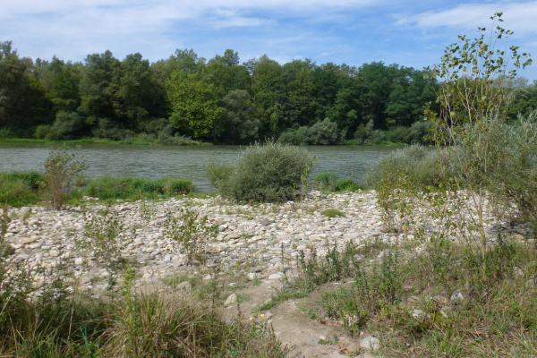
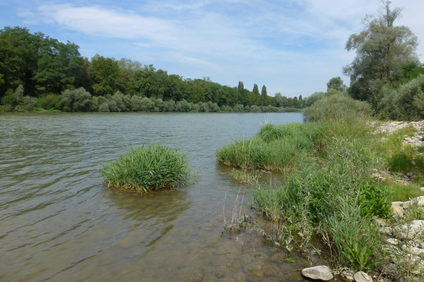
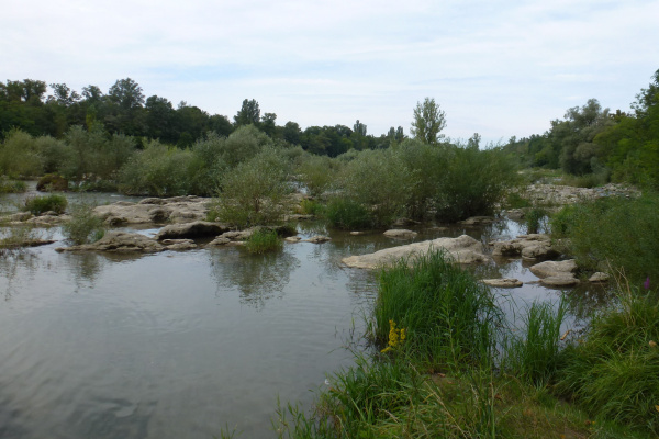
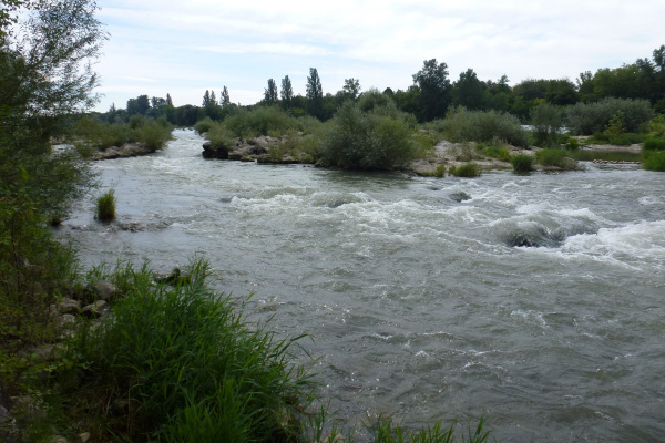
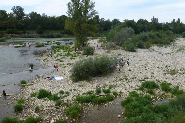
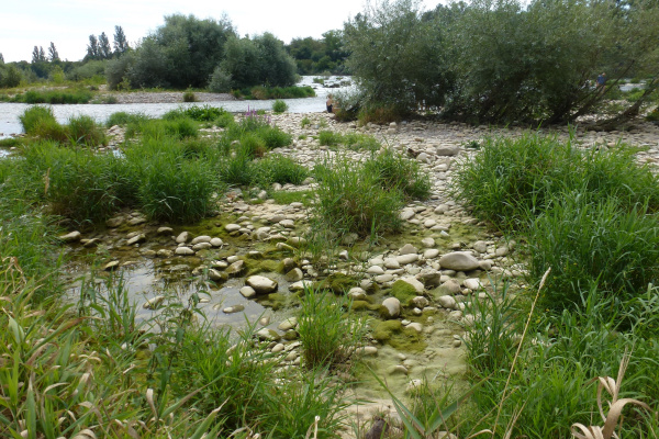
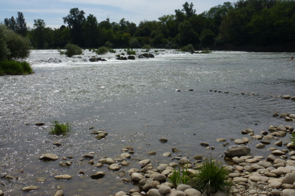
The impressive Isteiner Schwellen (Istein rapids) run in the Altrhein parallel to the Rhine side canal built in 1928, the Grand Canal d'Alsace, near the South Baden village of Istein in the municipality of Efringen-Kirchen. They transform the river landscape with its small sand and stone beaches into a popular bathing and picnic spot. Here the river flows over the Malm limestone rocks and has thus formed a wild landscape. The river section is reminiscent of the former floodplain landscape of the uncorrected Upper Rhine. Various stairways in the embankment lead to paths on the Malm sill and the gravel islands. Before the construction of the Grand Canal, the sills made navigation impossible at times during low water.
On an observation platform of the Isteiner Schwellen, one can watch goosanders fishing and observe the slowly fluttering damselflies along the bank. In the "Integrated Rhine Programme" for flood protection, a new spillway for the Feuerbach was also built at the Isteiner Schwellen. Flooding of these areas during floods is intended to prevent flooding in the Cologne region and at the same time re-create natural and ecologically valuable floodplain habitats.
Tour
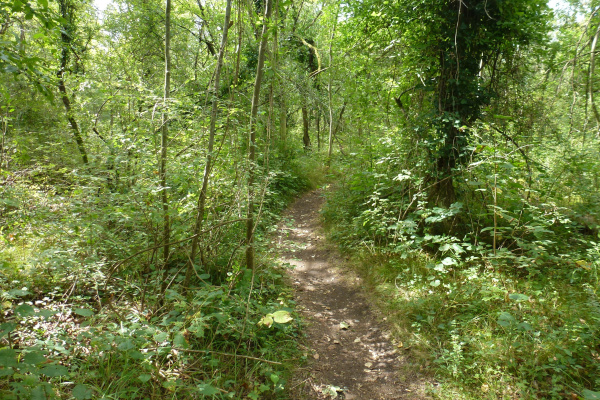
A popular circular walk starts in Efringen-Kirchen at the railway station, where the Isteiner Schwellen are already signposted on signposts. Follow the signs to "Kirchen, Altes Rathaus" and "Isteiner Schwellen (3 km)" and walk along the Feuerbach stream at the Gutenau signpost to the Isteiner Schwellen. From here, the Rheinaueweg runs over the newly built bridge along the Rhine to the Isteiner Klotz, where you have a fantastic view in the direction of France, of the Rhine, the Rhine side canal, the Burgundian Gate, the Vosges as well as in the direction of Switzerland to Basel, the Swiss Jura and much more. The hike now leads on the marked Klotzenrundweg to a forest path with a sports field and finally on the asphalted Klotzenweg to the sports field Huttingen. After about 3 km you reach the Bildstöckli viewpoint, the highest point of the tour. On the Römerstrasse, past the cemetery chapel, you go slightly downhill through vineyards to the signpost "Überm Kalkwerk" and from there along a section of the panoramic trail Schafberg, which is 3.6 km long in total. After the signpost "Efringen Altes Rathaus", return to the station.
The area is neither pram nor wheelchair accessible.
Refreshments
Along the Altrhein riverbank path there are fixed picnic areas with barbecue and fireplaces as well as tables and benches at various points. However, on sunny weekends or afternoons when there is no school, these facilities are not sufficient. Most visitors therefore bring their own barbecue. Istein and especially Efringen-Kirchen also have several restaurants and shopping facilities.
Other greenbelt sites in the vicinity
Further information
Here you will find further information from our partner regionatur.ch on the topics of 'floodplain forests', 'floods/flooding' and the integrated Rhine programme.
Barbecue / fireplace, Bathing opportunity, By the water, Excursion with animals, Excursion with children, Hike (good footwear), Viewpoint
Bicycle, Car, Public transport
Barbecue / fireplace, Food must be brought along, Picnic area
Amphibians, Birds, Cultural landscape / meadows, Fishes, Insects, Reptiles, Waters, Wetland
Tour
Families, Groups (< 10 persons), Groups (> 10 persons), Hikers, Pets, School classes
Arrival is possible by public transport as well as by bicycle and car. From the car park at the mouth of the Feuerbach, it is only a few metres on foot along the Rhine bank path to the Istein thresholds.
Calculate route
Your email address will not be published.